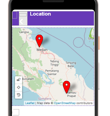
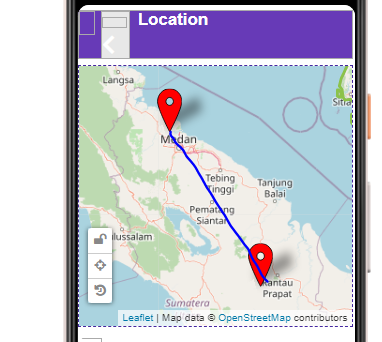
From the picture, user will input the latitude and longitude. Then the system will create marker on the map. I want to know is there a way for the system to also create line on the marker. For example at the picture below.
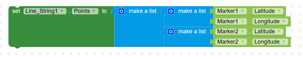
If there is a way, can you show me the coding block.
This topic was automatically closed 30 days after the last reply. New replies are no longer allowed.